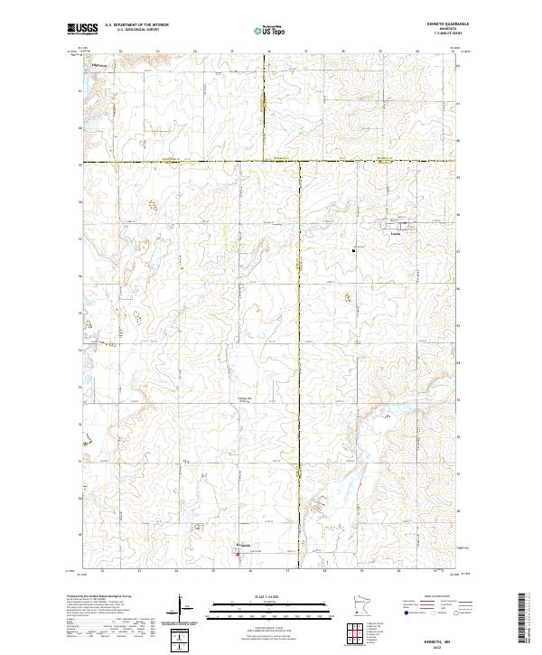
2022 Map of Kenneth
USGS Topo · Published 2022About this map
Kenneth and Leota anchor this agricultural landscape in southwestern Minnesota, situated atop the prominent geological upland known as the Coteau des Prairies. The survey reveals a highly organized grid of rural roads and section lines spanning the borders of Pipestone, Murray, Rock, and Nobles Counties. The village of Leota is a focal point for local history, featuring its own Leota Cem and a central post office marked Po. The terrain is defined by the drainage patterns of Chanarambie Cr in the north and Champepadan Cr in the south, which carve gentle valleys through the high prairie. Large-scale farming dominates the region, with the map recording the exact positioning of farmsteads and rural infrastructure that have sustained these communities for generations.
Find a feature on this map
58 named features on this map. Tap any name to fly to it.
Don’t see what you’re looking for? This feature index may not catch every label — zoom into the map to look around manually.
Map Details
Editions of this 2022 Kenneth Map
This is the sole edition of this map. No revisions or reprints were ever made.
Other maps of this area

1954 · Fairmont
USGS Topo · 1:250,000

1955 · Sioux Falls
USGS Topo · 1:250,000

1958 · Sioux Falls
USGS Topo · 1:250,000

1958 · Fairmont
USGS Topo · 1:250,000

1967 · Edgerton South
USGS Topo · 1:24,000

1967 · Slayton SW
USGS Topo · 1:24,000

1967 · Magnolia
USGS Topo · 1:24,000

1967 · Edgerton North
USGS Topo · 1:24,000

1967 · Edgerton NE
USGS Topo · 1:24,000

1967 · Kenneth
USGS Topo · 1:24,000