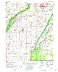
1956 Map of Kennett
USGS Topo · Published 1975About this map
Kennett serves as the focal point for this mid-century survey of Missouri’s bootheel, a landscape defined by an extensive reclamation system of man-made drainage ditches and natural sloughs. The St Louis Southwestern Railway cuts a diagonal path through the region, connecting agricultural hubs like Senath, Arbyrd, and Hornersville. This map illustrates the transition of the swampy bottomlands of the St Francis River into productive farmland, as evidenced by the dense grid of numbered canals such as Main Ditch No 10 and Ditch No 36. Numerous family and community landmarks appear throughout the rural sections, including Harkeys Chapel, Lula Ch & Cem, and the Bootheel Air Field. Small, named settlements like Bucoda and Cotton Plant provide a detailed look at the rural settlement patterns before the further consolidation of these communities.
Find a feature on this map
158 named features on this map. Tap any name to fly to it.
Don’t see what you’re looking for? This feature index may not catch every label — zoom into the map to look around manually.
Map Details
Editions of this 1956 Kennett Map
2 editions found

Other maps of this area

1934 · Kennett
USGS Topo · 1:62,500

1935 · Rector
USGS Topo · 1:62,500

1939 · Blytheville
USGS Topo · 1:62,500

1940 · Pascola
USGS Topo · 1:62,500

1940 · Marmaduke
USGS Topo · 1:62,500

1940 · Kennett
USGS Topo · 1:62,500

1940 · Hayti
USGS Topo · 1:62,500

1940 · Piggott
USGS Topo · 1:62,500

1941 · Leachville
USGS Topo · 1:62,500

1941 · Manila
USGS Topo · 1:62,500