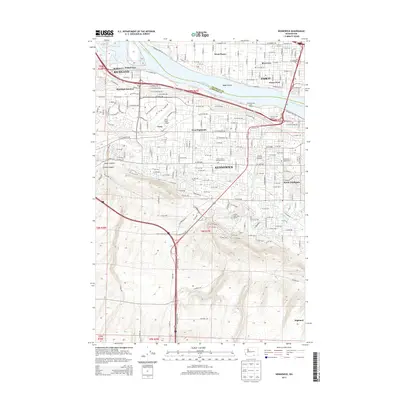
2013 Map of Kennewick
USGS Topo · Published 2013About this map
Kennewick and its neighboring Tri-Cities communities are defined by the convergence of the Columbia River and Yakima River during the early 21st century. This survey documents the intricate water management system essential to the region, featuring the Highland Feeder Canal, A-P Canal, and Division Four Canal that traverse the residential and agricultural landscape. The urban development of Richland and Pasco is shown in detail, connected by the BNSF Railway and major thoroughfares.
Find a feature on this map
165 named features on this map. Tap any name to fly to it.
Don’t see what you’re looking for? This feature index may not catch every label — zoom into the map to look around manually.
Map Details
Editions of this 2013 Kennewick Map
This is the sole edition of this map. No revisions or reprints were ever made.
Other maps of this area

1917 · Pasco
USGS Topo · 1:125,000

1951 · Richland
USGS Topo · 1:62,500

1953 · Walla Walla
USGS Topo · 1:250,000

1958 · Walla Walla
USGS Topo · 1:250,000
1964 · Johnson Butte
USGS Topo · 1:24,000
1964 · Nine Canyon
USGS Topo · 1:24,000

1964 · Kennewick
USGS Topo · 1:24,000

1964 · Pasco
USGS Topo · 1:62,500
1964 · Pasco
USGS Topo · 1:24,000

1965 · Eltopia
USGS Topo · 1:62,500