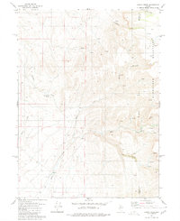
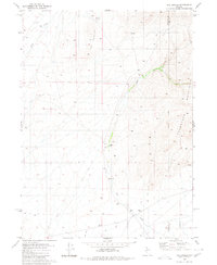
1980 Map of Kenny Creek
USGS Topo · Published 1980About this map
Kelly Creek Ranch sits at the southern reach of this arid basin, a rare point of named habitation where the drainage of Kelly Creek meets the lower slopes. The landscape is defined by the eastern rise of the Snowstorm Mountains, where high-elevation springs like Kelly Creek Spring feed the intermittent watercourses below. This 1980 survey captures a working landscape of the Great Basin, marked by small-scale resource extraction and livestock management. Evidence of mining history appears in the form of unnamed Prospects situated near the county boundary, while the presence of a Corral and various jeep trails suggests the ongoing use of the land for ranching. The topographical data reveals the transition from the relatively level basin floor near Rabbit to the sharp relief of the mountains, including the distinct terrain of Chimney and the drainage of Twentyone Creek.
Find a feature on this map
17 named features on this map. Tap any name to fly to it.
Don’t see what you’re looking for? This feature index may not catch every label — zoom into the map to look around manually.
Map Details
Editions of this 1980 Kenny Creek Map
This is the sole edition of this map. No revisions or reprints were ever made.
Other maps of this area

1882 · Paradise
USGS Topo · 1:250,000

1893 · Paradise
USGS Topo · 1:250,000

1955 · McDermitt
USGS Topo · 1:250,000

1959 · McDermitt
USGS Topo · 1:250,000
1965 · Jake Creek Mtn
USGS Topo · 1:24,000

1973 · Snowstorm Mtn
USGS Topo · 1:24,000
1973 · Rodear Flat
USGS Topo · 1:24,000
1980 · Layton Spring
USGS Topo · 1:24,000

1980 · Dry Hills South
USGS Topo · 1:24,000
1980 · The Knolls
USGS Topo · 1:24,000