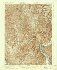
1907 Map of Keno
USGS Topo · Published 1936About this map
The Ohio River snakes through the heart of this early twentieth-century landscape, defining the border between Ohio and West Virginia. Small river towns like Hockingport and Reedsville serve as critical points of contact where the water economy meets the agrarian interior. To the north, the Hocking River converges with the Ohio near Coolville, where the Baltimore and Ohio RR provides a vital inland connection. The topography is deeply dissected, with ridges such as Jasper Hill and Brimstone Ridge rising above a dense network of runs and hollows.
Find a feature on this map
92 named features on this map. Tap any name to fly to it.
Don’t see what you’re looking for? This feature index may not catch every label — zoom into the map to look around manually.
Map Details
Editions of this 1907 Keno Map
3 editions found
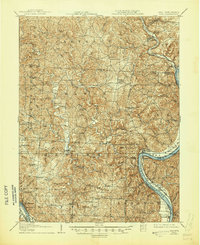
Other maps of this area

1902 · Parkersburg
USGS Topo · 1:62,500

1903 · Athens
USGS Topo · 1:62,500

1904 · Parkersburg
USGS Topo · 1:62,500

1904 · Chesterhill
USGS Topo · 1:62,500

1905 · Athens
USGS Topo · 1:62,500

1906 · Belleville
USGS Topo · 1:62,500

1906 · Chesterhill
USGS Topo · 1:62,500

1907 · Pomeroy
USGS Topo · 1:62,500

1907 · Keno
USGS Topo · 1:62,500

1907 · Ripley
USGS Topo · 1:62,500