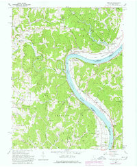
1960 Map of Portland
USGS Topo · Published 1978About this map
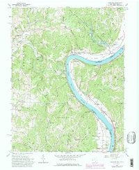
Shade River State Forest dominates the northern reaches of this Meigs County survey, where the Shade River and its numerous tributaries like Bigley Ridge Run carve through the landscape toward the Ohio River. The river's sharp bend at Long Bottom serves as a focal point for settlement, flanked by the Baltimore and Ohio railroad which tracks the shoreline past Murraysville and Portland. This era shows a community deeply rooted in its local geography, with numerous family-named landmarks such as Laucks Chapel Cem and Middleswart Cem marking the rural uplands.
Find a feature on this map
97 named features on this map. Tap any name to fly to it.
Don’t see what you’re looking for? This feature index may not catch every label — zoom into the map to look around manually.
Map Details
Editions of this 1960 Portland Map
5 editions found
Other maps of this area

1906 · Belleville
USGS Topo · 1:62,500

1907 · Keno
USGS Topo · 1:62,500

1907 · Ripley
USGS Topo · 1:62,500

1908 · Ravenswood
USGS Topo · 1:62,500

1924 · Belleville
USGS Topo · 1:62,500

1926 · Ravenswood
USGS Topo · 1:62,500

1926 · Belleville
USGS Topo · 1:62,500

1926 · Ripley
USGS Topo · 1:62,500

1928 · Ravenswood
USGS Topo · 1:62,500

1928 · Ripley
USGS Topo · 1:62,500