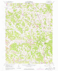
1960 Map of Shade
USGS Topo · Published 1977About this map
Shade River and its intricate tributaries, including Pratts Fork and West Branch Shade River, define the landscape of southeastern Ohio as it appeared in the mid-20th century. The territory is marked by the boundary between Athens and Meigs counties, showing a rural character transitioning through the 1960s and 1970s. Dispersed settlements like Snowville, Burlingham, and Darwin are connected by a network of ridge-top roads such as Helwig Ridge Road and Gilrey Ridge Road.
Find a feature on this map
41 named features on this map. Tap any name to fly to it.
Don’t see what you’re looking for? This feature index may not catch every label — zoom into the map to look around manually.
Map Details
Editions of this 1960 Shade Map
3 editions found
Other maps of this area

1903 · Athens
USGS Topo · 1:62,500

1904 · Chesterhill
USGS Topo · 1:62,500

1905 · Athens
USGS Topo · 1:62,500

1906 · Chesterhill
USGS Topo · 1:62,500

1907 · Pomeroy
USGS Topo · 1:62,500

1907 · Keno
USGS Topo · 1:62,500

1947 · Columbus
USGS Topo · 1:250,000

1949 · Clarksburg
USGS Topo · 1:250,000

1956 · Clarksburg
USGS Topo · 1:250,000

1960 · Albany
USGS Topo · 1:24,000