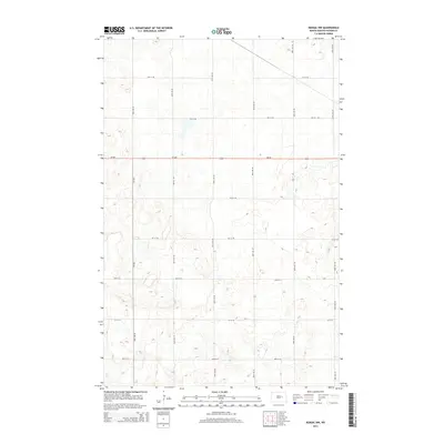
2014 Map of Kensal NW
USGS Topo · Published 2014About this map
Nd-200 bisects this Foster County landscape, providing the primary east-west corridor through a region defined by its characteristic prairie pothole topography. The map illustrates a strictly organized section-line road network typical of the Great Plains, where 87th Ave NE and 85th Ave NE run north-south through a terrain dotted with numerous small, unnamed wetlands and depressions. The presence of Main St E and Cr-1621 suggests the proximity of local rural activity and the intersections that historically served as gathering points for the surrounding agricultural community. For researchers, the 2014 survey reveals the persistent grid of county roads, such as 1st St NE and 5th St NE, which have anchored property boundaries and homestead access since the era of original settlement.
Find a feature on this map
22 named features on this map. Tap any name to fly to it.
Don’t see what you’re looking for? This feature index may not catch every label — zoom into the map to look around manually.
Map Details
Editions of this 2014 Kensal NW Map
This is the sole edition of this map. No revisions or reprints were ever made.
Other maps of this area

1900 · Pingree
USGS Topo · 1:125,000

1944 · Brantford
USGS Topo · 1:62,500

1946 · Brantford
USGS Topo · 1:62,500

1949 · Grace City
USGS Topo · 1:24,000

1950 · Grace City
USGS Topo · 1:24,000

1951 · Bordulac NE
USGS Topo · 1:24,000

1951 · Arrowwood Lake
USGS Topo · 1:24,000

1951 · Kensal
USGS Topo · 1:24,000

1951 · Kensal NW
USGS Topo · 1:24,000

1951 · Kensal SE
USGS Topo · 1:24,000