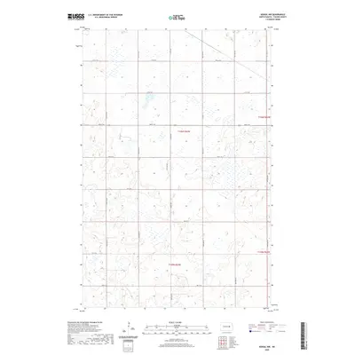
2020 Map of Kensal NW
USGS Topo · Published 2020About this map
Glacial prairie potholes and seasonal wetlands dominate this Foster County landscape, appearing as a complex network of depressions across the North Dakota plains. The map reflects a highly structured rural grid, where transportation follows the Public Land Survey System lines, anchored by North-South corridors like Juanita Rd and 85th Ave NE. While the terrain remains primarily dedicated to agriculture, the presence of Main St E on the eastern edge indicates the approach to local commerce. The township boundaries, including t146n r63w and t145n r63w, divide the territory into the traditional six-mile square blocks that have defined the Midwest since the initial land patents. This 2020 survey provides a precise account of modern section roads and the natural drainage patterns of the prairie before they are altered by seasonal shifts.
Find a feature on this map
25 named features on this map. Tap any name to fly to it.
Don’t see what you’re looking for? This feature index may not catch every label — zoom into the map to look around manually.
Map Details
Editions of this 2020 Kensal NW Map
This is the sole edition of this map. No revisions or reprints were ever made.
Other maps of this area

1900 · Pingree
USGS Topo · 1:125,000

1944 · Brantford
USGS Topo · 1:62,500

1946 · Brantford
USGS Topo · 1:62,500

1949 · Grace City
USGS Topo · 1:24,000

1950 · Grace City
USGS Topo · 1:24,000

1951 · Bordulac NE
USGS Topo · 1:24,000

1951 · Arrowwood Lake
USGS Topo · 1:24,000

1951 · Kensal
USGS Topo · 1:24,000

1951 · Kensal NW
USGS Topo · 1:24,000

1951 · Kensal SE
USGS Topo · 1:24,000