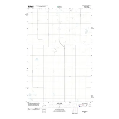
2011 Map of Kensal SE
USGS Topo · Published 2011About this map
Eastman Cemetery sits alone in the northern reaches of this rural Stutsman County landscape, serving as a primary point of interest for genealogists and local historians. This region of North Dakota is defined by its strict rectangular grid system, where section lines are traced by thoroughfares such as 3rd St SE and 92nd Ave SE. Small, scattered wetlands and depressions dot the prairie, highlighting the natural drainage patterns of the terrain. The map captures the area in the early 21st century, illustrating a sparsely populated agricultural expanse where road names like 10th St SE and 11th St SE delineate the vast farm plots of the Great Plains. The layout reflects a century of land management focused on large-scale cultivation and the endurance of local family burial grounds.
Find a feature on this map
16 named features on this map. Tap any name to fly to it.
Don’t see what you’re looking for? This feature index may not catch every label — zoom into the map to look around manually.
Map Details
Editions of this 2011 Kensal SE Map
This is the sole edition of this map. No revisions or reprints were ever made.
Other maps of this area

1900 · Pingree
USGS Topo · 1:125,000

1951 · Kensal
USGS Topo · 1:24,000

1951 · Kensal NW
USGS Topo · 1:24,000

1951 · Courtenay
USGS Topo · 1:24,000

1951 · Kensal SE
USGS Topo · 1:24,000

1951 · Glenfield
USGS Topo · 1:24,000

1952 · Courtenay NW
USGS Topo · 1:24,000

1952 · New Rockford
USGS Topo · 1:250,000

1956 · New Rockford
USGS Topo · 1:250,000

1961 · Sutton
USGS Topo · 1:24,000