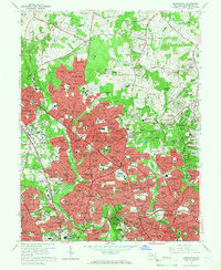
1965 Map of Kensington
USGS Topo · Published 1966About this map
Montgomery County suburbanization reaches a fever pitch in the mid-1960s, as shown by the dense red-tinted residential developments surrounding Kensington and Wheaton. The landscape is transitioning from the rolling hills of the Northwest Branch Park and Rock Creek Park into a modern metropolitan corridor defined by the Capitol Beltway and Washington National Pike. Major institutional footprints dominate the southern portion of the sheet, including the sprawling grounds of the National Institutes of Health and the Naval Medical Center.
Find a feature on this map
234 named features on this map. Tap any name to fly to it.
Don’t see what you’re looking for? This feature index may not catch every label — zoom into the map to look around manually.
Map Details
Editions of this 1965 Kensington Map
4 editions found
Other maps of this area

1890 · Mt. Vernon
USGS Topo · 1:125,000

1891 · Mt. Vernon
USGS Topo · 1:125,000

1892 · Laurel
USGS Topo · 1:62,500

1893 · Frederick
USGS Topo · 1:125,000

1894 · Laurel
USGS Topo · 1:62,500

1894 · Frederick
USGS Topo · 1:125,000

1894 · Mt. Vernon
USGS Topo · 1:125,000

1897 · Laurel
USGS Topo · 1:62,500

1897 · Mt. Vernon
USGS Topo · 1:125,000

1899 · Patuxent
USGS Topo · 1:125,000