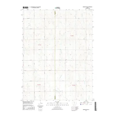
2015 Map of Kensington NE
USGS Topo · Published 2015About this map
The rolling hills along the border of Phillips and Smith Co are defined by a rhythmic drainage pattern of north-flowing creeks in this 2015 study. The landscape is carved by several distinct watercourses, including the W Middle Cedar Cr, E Middle Cedar Cr, and E Cedar Cr, which move through a sectioned grid of rural roads. A central landmark of historical significance is the Stone Cem, located near the intersection of 60 Rd and B Rd. This small burial ground serves as a silent witness to the early families who settled these uplands. The road system, labeled alphabetically and numerically such as A Rd and 90 Rd, provides a framework for understanding the agricultural distribution across the townships of t1s r16w and t2s r15w. Smaller tributaries like Rebecca Cr and Lost Cr further articulate the topography of this high plains region.
Find a feature on this map
33 named features on this map. Tap any name to fly to it.
Don’t see what you’re looking for? This feature index may not catch every label — zoom into the map to look around manually.
Map Details
Editions of this 2015 Kensington NE Map
This is the sole edition of this map. No revisions or reprints were ever made.
Other maps of this area

1893 · Smith Center
USGS Topo · 1:125,000

1893 · Phillipsburg
USGS Topo · 1:125,000

1896 · Holdrege
USGS Topo · 1:125,000

1897 · Red Cloud
USGS Topo · 1:125,000

1955 · Grand Island
USGS Topo · 1:250,000

1955 · Beloit
USGS Topo · 1:250,000

1957 · Grand Island
USGS Topo · 1:250,000

1958 · Grand Island
USGS Topo · 1:250,000

1959 · Beloit
USGS Topo · 1:250,000

1973 · Kensington
USGS Topo · 1:24,000