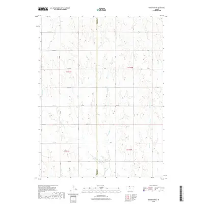
2018 Map of Kensington NE
USGS Topo · Published 2018About this map
Stone Cem sits near the heart of this landscape along the border of Phillips and Smith Counties. The terrain is defined by a dendritic network of drainages including E Middle Cedar Cr, W Middle Cedar Cr, and Rebecca Cr. This map documents a strictly organized rural grid of section-line roads, such as E Buffalo Rd and E Cherokee Rd, that divide the undulating plains into precise agricultural blocks. The absence of concentrated town centers highlights the traditional rural character of the region, where family farms are connected by a naming convention of thoroughfares like E Dakota Rd and E Eagle Rd. This survey provides a baseline of 21st-century land use, showing how historical property lines and small community landmarks like local cemeteries persist amidst the wide Kansas landscape.
Find a feature on this map
33 named features on this map. Tap any name to fly to it.
Don’t see what you’re looking for? This feature index may not catch every label — zoom into the map to look around manually.
Map Details
Editions of this 2018 Kensington NE Map
This is the sole edition of this map. No revisions or reprints were ever made.
Other maps of this area

1893 · Smith Center
USGS Topo · 1:125,000

1893 · Phillipsburg
USGS Topo · 1:125,000

1896 · Holdrege
USGS Topo · 1:125,000

1897 · Red Cloud
USGS Topo · 1:125,000

1955 · Grand Island
USGS Topo · 1:250,000

1955 · Beloit
USGS Topo · 1:250,000

1957 · Grand Island
USGS Topo · 1:250,000

1958 · Grand Island
USGS Topo · 1:250,000

1959 · Beloit
USGS Topo · 1:250,000

1973 · Kensington
USGS Topo · 1:24,000