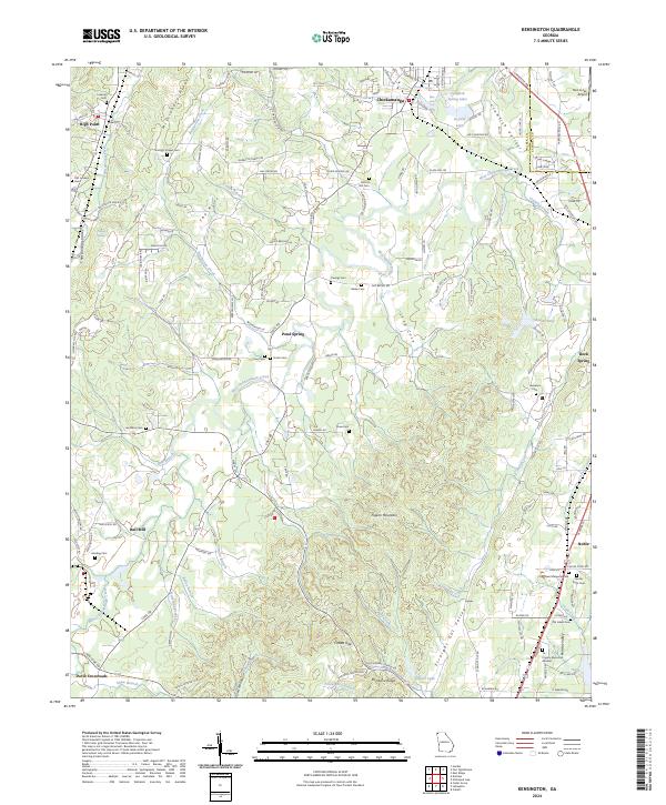
2024 Map of Kensington
USGS Topo · Published 2024About this map
Chickamauga and its prominent Crawfish Spring Lake anchor the northern landscape of this Walker County region, where the terrain is defined by the parallel elevations of Missionary Ridge and Shinbone Ridge. The map details a dense network of local landmarks essential for genealogical research, including family-named sites like District Hill Cem, Owings Cem, and Garmany Cem. The valley floors are drained by West Chickamauga Creek and Crawfish Creek, which separate the rugged rises of Pigeon Mountain from the residential and agricultural pockets at Pond Spring and Hall Mill. This 2024 survey documents the enduring rural character of the area, tracing small settlements from High Point in the northwest to Noble and Davis Crossroads in the south. The abundance of cemeteries and small church sites like Garretts Chapel reflects the deep-rooted community history of the Straight Gut Valley and Crawfish Valley.
Find a feature on this map
153 named features on this map. Tap any name to fly to it.
Don’t see what you’re looking for? This feature index may not catch every label — zoom into the map to look around manually.
Map Details
Editions of this 2024 Kensington Map
This is the sole edition of this map. No revisions or reprints were ever made.
Other maps of this area

1886 · Ringgold
USGS Topo · 1:125,000

1892 · Ringgold
USGS Topo · 1:125,000

1935 · Catlett
USGS Topo · 1:24,000

1935 · East Ridge
USGS Topo · 1:24,000

1935 · Durham
USGS Topo · 1:24,000

1935 · Nickajack Gap
USGS Topo · 1:24,000

1936 · Kensington
USGS Topo · 1:24,000

1936 · Hooker
USGS Topo · 1:24,000

1936 · Estelle
USGS Topo · 1:24,000

1936 · Fort Oglethorpe
USGS Topo · 1:24,000