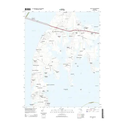
2014 Map of Kent Island
USGS Topo · Published 2014About this map
Stevensville and Chester serve as the primary hubs on this map of Kent Island, situated where the William Preston Lane Junior Memorial Bridge connects the Eastern Shore to the mainland across the Chesapeake Bay. The 2014 survey reveals a landscape defined by dense residential growth and maritime access, with numerous waterfront communities such as Cloverfields, Bay City, and Matapeake Estates lining the indented shoreline.
Find a feature on this map
134 named features on this map. Tap any name to fly to it.
Don’t see what you’re looking for? This feature index may not catch every label — zoom into the map to look around manually.
Map Details
Editions of this 2014 Kent Island Map
This is the sole edition of this map. No revisions or reprints were ever made.
Other maps of this area

1892 · Annapolis
USGS Topo · 1:62,500

1893 · North Point
USGS Topo · 1:62,500

1898 · Choptank
USGS Topo · 1:125,000

1898 · Tolchester
USGS Topo · 1:125,000

1901 · Chestertown
USGS Topo · 1:62,500

1903 · Tolchester
USGS Topo · 1:125,000

1904 · St. Michaels
USGS Topo · 1:62,500

1904 · North Point
USGS Topo · 1:62,500

1904 · Annapolis
USGS Topo · 1:62,500

1908 · Tolchester
USGS Topo · 1:125,000