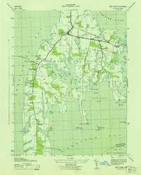
1943 Map of Kent Island
USGS Topo · Published 1943About this map
Kent Island is depicted during the early 1940s as a critical transit hub in the Chesapeake Bay, defined by its ferry connections and rail terminal. Before the bay was spanned by a bridge, the Annapolis-Matapeake Ferry and Claiborne Ferry served as the primary conduits for cross-bay travel, linking the island's road network to the mainland. The Baltimore and Eastern railroad traverses the northern portion of the island, terminating at the RR Station near Chester, illustrating the historic reliance on integrated rail-and-water transport. Local life is anchored by traditional community centers such as Wesley Church, Kingsley Church, and the Batts Neck School. The coastal landscape is deeply articulated by tidal inlets like Cox Creek, Shipping Creek, and Crab Alley Bay, while smaller settlements including Stevensville and Dominion mark the interior and eastern shorelines.
Find a feature on this map
50 named features on this map. Tap any name to fly to it.
Don’t see what you’re looking for? This feature index may not catch every label — zoom into the map to look around manually.
Map Details
Editions of this 1943 Kent Island Map
This is the sole edition of this map. No revisions or reprints were ever made.
Other maps of this area

1892 · Annapolis
USGS Topo · 1:62,500

1893 · North Point
USGS Topo · 1:62,500

1898 · Choptank
USGS Topo · 1:125,000

1898 · Tolchester
USGS Topo · 1:125,000

1901 · Chestertown
USGS Topo · 1:62,500

1903 · Tolchester
USGS Topo · 1:125,000

1904 · St. Michaels
USGS Topo · 1:62,500

1904 · North Point
USGS Topo · 1:62,500

1904 · Annapolis
USGS Topo · 1:62,500

1908 · Tolchester
USGS Topo · 1:125,000