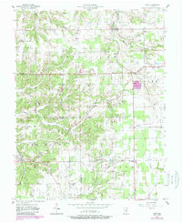
1956 Map of Kent
USGS Topo · Published 1988About this map
Kent serves as a primary settlement point in this mid-century survey of the Jefferson and Scott County borderlands. The landscape is defined by the winding paths of Ramsey Creek and Fourteenmile Creek, which carve through the terrain near established rural communities like Swanville and Chelsea. For those tracing local heritage, the map identifies numerous centers of community life, including the Pleasant Point Sch and several country churches such as Sharon Hill Ch and New Bethel Ch.
Find a feature on this map
30 named features on this map. Tap any name to fly to it.
Don’t see what you’re looking for? This feature index may not catch every label — zoom into the map to look around manually.
Map Details
Editions of this 1956 Kent Map
4 editions found
Other maps of this area

1939 · Bethlehem
USGS Topo · 1:24,000

1939 · Madison West
USGS Topo · 1:24,000

1948 · Bethlehem
USGS Topo · 1:24,000

1948 · Madison West
USGS Topo · 1:24,000

1953 · Madison West
USGS Topo · 1:24,000

1953 · Bethlehem
USGS Topo · 1:24,000

1956 · Otisco
USGS Topo · 1:24,000

1956 · Volga
USGS Topo · 1:24,000

1956 · Blocher
USGS Topo · 1:24,000

1956 · Kent
USGS Topo · 1:24,000