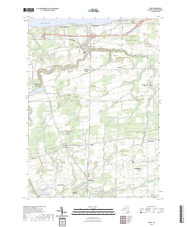
2023 Map of Kent
USGS Topo · Published 2023About this map
The Erie Canal cuts across the southern portion of this Orleans County landscape, passing just north of the village of Albion. This modern survey illustrates the enduring agricultural and shoreline character of the region as it meets Lake Ontario. At the mouth of Oak Orchard Creek, the community of Point Breeze sits near Brighton Cliff, while the inland terrain is defined by the winding paths of Marsh Creek and Beardsley Creek. Local history is preserved in a series of small burial grounds, including Gaines Cem, Standish Cem, and the Union Cem. The area’s aviation connections are marked by facilities such as Gaines Valley Aviation and Dawn Patrol Aviation, located between the residential clusters of Gaines and Childs. Transportation routes like the Lake Ontario State Pkwy and the historic Roosevelt Hwy connect the lakeside hamlets to the interior crossroads of Five Corners and Baldwin Corner.
Find a feature on this map
56 named features on this map. Tap any name to fly to it.
Don’t see what you’re looking for? This feature index may not catch every label — zoom into the map to look around manually.
Map Details
Editions of this 2023 Kent Map
This is the sole edition of this map. No revisions or reprints were ever made.
Other maps of this area

1897 · Albion
USGS Topo · 1:62,500

1897 · Medina
USGS Topo · 1:62,500

1897 · Oak Orchard
USGS Topo · 1:62,500

1897 · Ridgeway
USGS Topo · 1:62,500

1944 · Holley
USGS Topo · 1:31,680

1944 · Ashwood
USGS Topo · 1:31,680

1944 · Albion
USGS Topo · 1:31,680

1949 · Kendall
USGS Topo · 1:62,500
1950 · Knowlesville
USGS Topo · 1:24,000
1950 · Holley
USGS Topo · 1:24,000