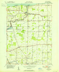
1951 Map of Kent
USGS Topo · Published 1951About this map
Lake Ontario defines the northern reaches of this coastal Orleans County landscape, where the waters of Oak Orchard Creek wind through deep bends toward Point Breeze. The area shows a mature mid-century rural infrastructure, characterized by a dense network of local education including School No 14, School No 16, and School No 6. The transportation corridor is anchored by the New York Central railroad, with stops at Waterport Sta and Kent (Brice Sta), facilitating the movement of goods from the surrounding orchards and farms.
Find a feature on this map
48 named features on this map. Tap any name to fly to it.
Don’t see what you’re looking for? This feature index may not catch every label — zoom into the map to look around manually.
Map Details
Editions of this 1951 Kent Map
This is the sole edition of this map. No revisions or reprints were ever made.
Other maps of this area

1897 · Albion
USGS Topo · 1:62,500

1897 · Medina
USGS Topo · 1:62,500

1897 · Oak Orchard
USGS Topo · 1:62,500

1897 · Ridgeway
USGS Topo · 1:62,500

1944 · Holley
USGS Topo · 1:31,680

1944 · Ashwood
USGS Topo · 1:31,680

1944 · Albion
USGS Topo · 1:31,680

1949 · Kendall
USGS Topo · 1:62,500
1950 · Knowlesville
USGS Topo · 1:24,000
1950 · Holley
USGS Topo · 1:24,000