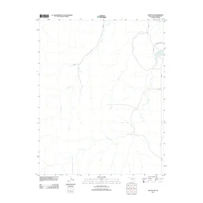
2012 Map of Kenton SW
USGS Topo · Published 2012About this map
Lake Carl Etling serves as a focal point in this high plains corner of the Oklahoma Panhandle, situated within the bounds of Black Mesa State Park. The landscape is defined by its dendritic drainage patterns, where seasonal watercourses like Tesesquite Cr and Willow Cr carve through the arid terrain. The map reveals a sparse network of section-line roads, including N0080 Rd and D0132 Rd, which navigate the elevation changes between the creek beds and the higher mesas. Farther south, the meandering path of S Carrizo Cr and the eastern flow of Swede Cr emphasize the importance of these water systems to the local topography and land use. This survey provides a clear view of the territorial structure and rural infrastructure in the far western reaches of Cimarron County.
Find a feature on this map
12 named features on this map. Tap any name to fly to it.
Don’t see what you’re looking for? This feature index may not catch every label — zoom into the map to look around manually.
Map Details
Editions of this 2012 Kenton SW Map
This is the sole edition of this map. No revisions or reprints were ever made.
Other maps of this area

1954 · Dalhart
USGS Topo · 1:250,000

1958 · Dalhart
USGS Topo · 1:250,000

1962 · Dalhart
USGS Topo · 1:250,000

1968 · Kenton
USGS Topo · 1:24,000

1969 · Wheeless
USGS Topo · 1:24,000

1969 · Felt NE
USGS Topo · 1:24,000

1969 · Kenton SE
USGS Topo · 1:24,000
1969 · Kenton NE
USGS Topo · 1:24,000
1969 · Kenton SW
USGS Topo · 1:24,000
1972 · Goodson School
USGS Topo · 1:24,000