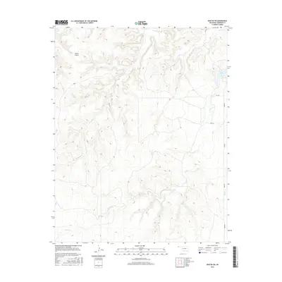
2016 Map of Kenton SW
USGS Topo · Published 2016About this map
Lake Carl Etling serves as a primary water feature in this corner of the Oklahoma Panhandle, situated near the headwaters of the regional creek system. The landscape is defined by the significant incision of Layton Canyon and the winding paths of several drainages, including Tesesquite Cr, Willow Cr, and S Carrizo Cr. This 2016 survey illustrates the sparsely populated, ranching-oriented character of Cimarron County, where movement is dictated by a grid of rural routes such as n0080 RD and e0132 RD. The convergence of Swede Cr with larger waterways underscores the importance of seasonal water management in this arid high-plains environment.
Find a feature on this map
13 named features on this map. Tap any name to fly to it.
Don’t see what you’re looking for? This feature index may not catch every label — zoom into the map to look around manually.
Map Details
Editions of this 2016 Kenton SW Map
This is the sole edition of this map. No revisions or reprints were ever made.
Other maps of this area

1954 · Dalhart
USGS Topo · 1:250,000

1958 · Dalhart
USGS Topo · 1:250,000

1962 · Dalhart
USGS Topo · 1:250,000

1968 · Kenton
USGS Topo · 1:24,000

1969 · Wheeless
USGS Topo · 1:24,000

1969 · Felt NE
USGS Topo · 1:24,000

1969 · Kenton SE
USGS Topo · 1:24,000
1969 · Kenton NE
USGS Topo · 1:24,000
1969 · Kenton SW
USGS Topo · 1:24,000
1972 · Goodson School
USGS Topo · 1:24,000