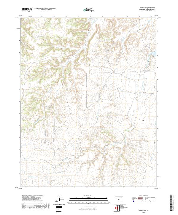
2022 Map of Kenton SW
USGS Topo · Published 2022About this map
Tesesquite Cr and Willow Cr wind through this corner of the Oklahoma Panhandle, carving a network of drainage patterns across the high plains of Cimarron County. The landscape is defined by its watercourses and the relief of Layton Canyon, illustrating the transition from flat prairie to the incised breaks characteristic of the region near the New Mexico and Colorado borders. Settlement is sparse, represented primarily by a grid of rural routes such as D0073 Rd and E0120 Rd that provide access to this isolated cattle country.
Find a feature on this map
19 named features on this map. Tap any name to fly to it.
Don’t see what you’re looking for? This feature index may not catch every label — zoom into the map to look around manually.
Map Details
Editions of this 2022 Kenton SW Map
This is the sole edition of this map. No revisions or reprints were ever made.
Other maps of this area

1954 · Dalhart
USGS Topo · 1:250,000

1958 · Dalhart
USGS Topo · 1:250,000

1962 · Dalhart
USGS Topo · 1:250,000

1968 · Kenton
USGS Topo · 1:24,000

1969 · Wheeless
USGS Topo · 1:24,000

1969 · Felt NE
USGS Topo · 1:24,000

1969 · Kenton SE
USGS Topo · 1:24,000
1969 · Kenton NE
USGS Topo · 1:24,000
1969 · Kenton SW
USGS Topo · 1:24,000
1972 · Goodson School
USGS Topo · 1:24,000