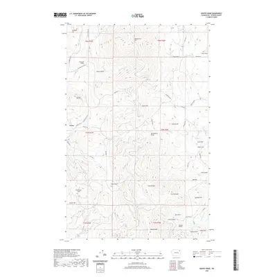
2020 Map of Kentry Ridge
USGS Topo · Published 2020About this map
The Arzina settlement area lies tucked within the complex topography of the Huckleberry Range in Stevens County, Washington. This modern survey illustrates a landscape defined by significant elevation changes, from the heights of Monumental Mtn and Granite Mtn down to the drainage basins of Quillisascut Cr and Cheweka Cr. The road network, including Orin Rice Rd and Pleasant Valley Rd, follows the natural contours of the land, connecting scattered homesteads and ranches through the various canyons. Named terrain features like Old Copper Hill, Kings Canyon, and Deadman Hill reflect a history of land use and local navigation in this mountainous region. The presence of Pleasant Valley and North Basin indicates the flatter, habitable zones where settlement concentrated amidst the surrounding ridges, while features like The Horseshoe and Twilight Canyon point to the geographic complexity that has shaped the area’s development.
Find a feature on this map
58 named features on this map. Tap any name to fly to it.
Don’t see what you’re looking for? This feature index may not catch every label — zoom into the map to look around manually.
Map Details
Editions of this 2020 Kentry Ridge Map
This is the sole edition of this map. No revisions or reprints were ever made.
Other maps of this area

1927 · Chewelah
USGS Topo · 1:125,000

1929 · Colville
USGS Topo · 1:125,000

1930 · Chewelah
USGS Topo · 1:125,000

1933 · Colville
USGS Topo · 1:125,000

1936 · Marcus
USGS Topo · 1:96,000

1942 · Marcus
USGS Topo · 1:125,000

1948 · Kettle Falls
USGS Topo · 1:62,500

1950 · Inchelium
USGS Topo · 1:62,500

1951 · Kettle Falls
USGS Topo · 1:62,500

1952 · Colville
USGS Topo · 1:24,000