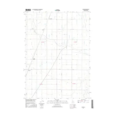
2017 Map of Kenyon
USGS Topo · Published 2017About this map
Beetville and Pella anchor this agricultural landscape in Cassia County, where a complex network of irrigation and drainage defines the local geography. The territory is crisscrossed by an extensive system of laterals and canals, including the J Canal and H Canal, alongside numerous smaller channels like Morgan Drain and Snipe Drain. This intricate water management system transformed the Idaho plains, supporting small communities and family farms. Near the settlement of Pella, the Ward Cem serves as a genealogical landmark, while the southern reaches are marked by the converging waters of Goose Cr, Big Rocky Cr, and Robinson Cr. The map captures the geometric precision of the grid system, with named thoroughfares like Pole Line Rd and Baseline Rd cutting through the terrain to connect North Kenyon with the surrounding countryside.
Find a feature on this map
62 named features on this map. Tap any name to fly to it.
Don’t see what you’re looking for? This feature index may not catch every label — zoom into the map to look around manually.
Map Details
Editions of this 2017 Kenyon Map
This is the sole edition of this map. No revisions or reprints were ever made.
Other maps of this area

1954 · Pocatello
USGS Topo · 1:250,000

1958 · Pocatello
USGS Topo · 1:250,000

1964 · Burley SW
USGS Topo · 1:24,000

1964 · View
USGS Topo · 1:24,000

1964 · Kenyon
USGS Topo · 1:24,000

1964 · Burley Butte
USGS Topo · 1:24,000

1964 · Rupert SW
USGS Topo · 1:24,000

1964 · Burley SE
USGS Topo · 1:24,000

1968 · Marion SE
USGS Topo · 1:24,000

1968 · Mount Harrison
USGS Topo · 1:24,000