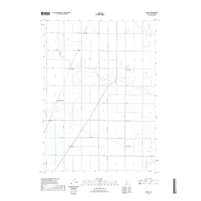
2020 Map of Kenyon
USGS Topo · Published 2020About this map
Cassia County's agricultural heritage is defined by the intricate water management systems that grid the landscape north of the mountains. The small settlements of Beetville and Pella serve as anchors for a rural community organized around a vast network of irrigation, including the J Canal, H Canal, and numerous lateral lines like J 27 Lateral. This 2020 record of the region shows the persistent importance of gravity-fed water, where natural drainages such as Goose Cr and Morgan Drain are integrated into a man-made hydraulic pattern. In the northwest, the Ward Cem remains a localized point of interest for family historians, while the southward progression of roads like Pole Line Rd and Baseline Rd connects the dispersed communities of North Kenyon and Kenyon. The southern reaches of the map give way to more natural features where Big Rocky Cr and Robinson Cr descend toward the valley floor.
Find a feature on this map
37 named features on this map. Tap any name to fly to it.
Don’t see what you’re looking for? This feature index may not catch every label — zoom into the map to look around manually.
Map Details
Editions of this 2020 Kenyon Map
This is the sole edition of this map. No revisions or reprints were ever made.
Other maps of this area

1954 · Pocatello
USGS Topo · 1:250,000

1958 · Pocatello
USGS Topo · 1:250,000

1964 · Burley SW
USGS Topo · 1:24,000

1964 · View
USGS Topo · 1:24,000

1964 · Kenyon
USGS Topo · 1:24,000

1964 · Burley Butte
USGS Topo · 1:24,000

1964 · Rupert SW
USGS Topo · 1:24,000

1964 · Burley SE
USGS Topo · 1:24,000

1968 · Marion SE
USGS Topo · 1:24,000

1968 · Mount Harrison
USGS Topo · 1:24,000