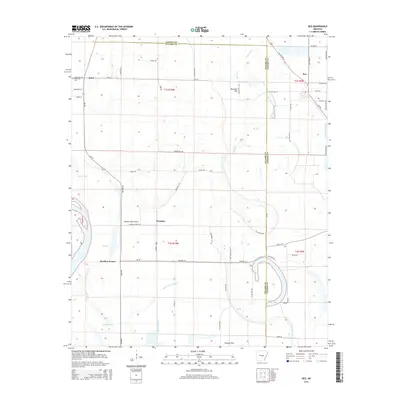
2014 Map of Keo
USGS Topo · Published 2014About this map
Keo and the rural communities of Wampoo, Estes, and Bredlow Corner anchor this survey of the Arkansas Delta along the Lonoke Co Pulaski Co line. The landscape is defined by the slow-moving drainage of the Mississippi Alluvial Plain, including the meandering course of Beaverdam Bayou, North Bayou, and the oxbow at Clear Lake. While Rounded Hill provides a rare point of elevation, much of the area consists of low-lying lands such as Possum Flat and Gar Slough. The region's agricultural character is evident in the dense network of local routes like Wampoo Lateral Rd and Honey Bee Rd, serving the Bredlow Farm Airport and small family burial grounds like Alexander Cem. This map records the established drainage patterns and road networks that have supported Arkansas's river-bottom farming for generations.
Find a feature on this map
61 named features on this map. Tap any name to fly to it.
Don’t see what you’re looking for? This feature index may not catch every label — zoom into the map to look around manually.
Map Details
Editions of this 2014 Keo Map
This is the sole edition of this map. No revisions or reprints were ever made.
Other maps of this area

1891 · Little Rock
USGS Topo · 1:125,000

1893 · Little Rock
USGS Topo · 1:125,000

1932 · Pastoria
USGS Topo · 1:62,500

1935 · Sweet Home
USGS Topo · 1:24,000

1935 · Altheimer
USGS Topo · 1:62,500

1935 · Pastoria
USGS Topo · 1:62,500

1937 · England
USGS Topo · 1:48,000

1939 · Keo
USGS Topo · 1:31,680

1940 · Woodson
USGS Topo · 1:31,680

1941 · Keo
USGS Topo · 1:31,680