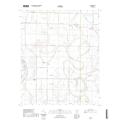
2020 Map of Keo
USGS Topo · Published 2020About this map
Keo and the surrounding agricultural bottomlands of the Arkansas River basin define this landscape, where oxbow lakes and complex bayou networks indicate a long history of shifting watercourses. The territory is marked by significant wetlands such as McNeely Brake and Clear Lake, remnants of the ancient river path that now serve as vital landmarks for local land divisions. In the north, the small settlement of Estes sits near Ash Flat Lake, while the central area is anchored by the community of Wampoo and the Bredlow Farm Airport. This modern survey details the intricate drainage system including Beaverdam Bayou and Wabbaseka Bayou, showing how irrigation and water management have shaped the development of Bredlow Corner and Possum Flat amidst a grid of rural roads like Fudge Rd and Walter Estes Rd.
Find a feature on this map
65 named features on this map. Tap any name to fly to it.
Don’t see what you’re looking for? This feature index may not catch every label — zoom into the map to look around manually.
Map Details
Editions of this 2020 Keo Map
This is the sole edition of this map. No revisions or reprints were ever made.
Other maps of this area

1891 · Little Rock
USGS Topo · 1:125,000

1893 · Little Rock
USGS Topo · 1:125,000

1932 · Pastoria
USGS Topo · 1:62,500

1935 · Sweet Home
USGS Topo · 1:24,000

1935 · Altheimer
USGS Topo · 1:62,500

1935 · Pastoria
USGS Topo · 1:62,500

1937 · England
USGS Topo · 1:48,000

1939 · Keo
USGS Topo · 1:31,680

1940 · Woodson
USGS Topo · 1:31,680

1941 · Keo
USGS Topo · 1:31,680