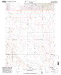
1997 Map of Keota SE
USGS Topo · Published 2000About this map
Pawnee National Grassland dominates the northern landscape of this High Plains survey, reflecting the conservation and land-use shifts of the late twentieth century. This specific quadrangle captures the boundary between Weld and Morgan Counties, revealing a terrain defined by sparse water sources and industrial exploration. Scattered Wells and a prominent Pipeline in the southeast corner indicate the region's reliance on subterranean resources, while several Drill Holes point to geological testing across the open range.
Find a feature on this map
7 named features on this map. Tap any name to fly to it.
Don’t see what you’re looking for? This feature index may not catch every label — zoom into the map to look around manually.
Map Details
Editions of this 1997 Keota SE Map
This is the sole edition of this map. No revisions or reprints were ever made.
Other maps of this area

1950 · Greasewood Lake
USGS Topo · 1:24,000

1951 · Sunken Lake
USGS Topo · 1:24,000

1951 · Judson Hills
USGS Topo · 1:24,000

1954 · Sterling
USGS Topo · 1:250,000

1954 · Greeley
USGS Topo · 1:250,000

1957 · Greeley
USGS Topo · 1:250,000

1958 · Greeley
USGS Topo · 1:250,000

1958 · Sterling
USGS Topo · 1:250,000

1961 · Greeley
USGS Topo · 1:250,000

1964 · Greeley
USGS Topo · 1:250,000