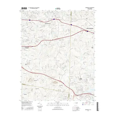
2016 Map of Kernersville
USGS Topo · Published 2016About this map
Kernersville anchors this geographic crossroads in the Piedmont Triad, where the urban boundaries of Winston-Salem, Greensboro, and High Point converge. The landscape is defined by its transition from historic rural settlements to modern suburban corridors, particularly along the Forsyth and Guilford County line. While major arteries like Old Winston Rd connect the larger cities, the interior of the map reveals established communities such as Teaguetown, Horneytown, and Georgetown.
Find a feature on this map
287 named features on this map. Tap any name to fly to it.
Don’t see what you’re looking for? This feature index may not catch every label — zoom into the map to look around manually.
Map Details
Editions of this 2016 Kernersville Map
This is the sole edition of this map. No revisions or reprints were ever made.
Other maps of this area

1949 · Eller
USGS Topo · 1:24,000

1949 · High Point West
USGS Topo · 1:24,000

1950 · High Point East
USGS Topo · 1:24,000

1950 · Winston-Salem East
USGS Topo · 1:24,000

1951 · Winston-Salem East
USGS Topo · 1:24,000

1951 · High Point East
USGS Topo · 1:24,000

1951 · Guilford
USGS Topo · 1:24,000

1951 · Walkertown
USGS Topo · 1:24,000

1953 · Raleigh
USGS Topo · 1:250,000

1953 · Charlotte
USGS Topo · 1:250,000