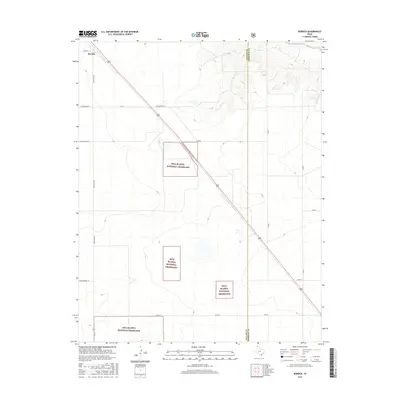
2016 Map of Kerrick
USGS Topo · Published 2016About this map
Kerrick sits at the northern edge of the Texas Panhandle, positioned along a straight diagonal highway corridor that cuts through the High Plains. This 2016 survey highlights the discontinuous patches of the Rita Blanca National Grassland, which are interspersed among private ranching and agricultural lands. The landscape is defined by its vastness and a precise grid of rural routes, including named family and ranch roads like Schoonover Ln, Minnie Mack Ln, and Whittenburg Ln. In the northeast corner, the topography shifts slightly where the Beaver River enters from the north, creating a more complex drainage pattern near the boundary between Dallam Co and Sherman Co. This map serves as a detailed record of the contemporary land management and transportation network in a sparsely populated but vital ranching region.
Find a feature on this map
19 named features on this map. Tap any name to fly to it.
Don’t see what you’re looking for? This feature index may not catch every label — zoom into the map to look around manually.
Map Details
Editions of this 2016 Kerrick Map
This is the sole edition of this map. No revisions or reprints were ever made.
Other maps of this area

1954 · Dalhart
USGS Topo · 1:250,000

1958 · Dalhart
USGS Topo · 1:250,000

1962 · Dalhart
USGS Topo · 1:250,000

1964 · Brickel
USGS Topo · 1:24,000

1964 · Kerrick
USGS Topo · 1:24,000

1964 · Stratford 2 SE
USGS Topo · 1:24,000

1964 · Stratford 2 NE
USGS Topo · 1:24,000

1964 · Stratford
USGS Topo · 1:24,000

1964 · Stratford NE
USGS Topo · 1:24,000

1971 · Griggs SW
USGS Topo · 1:24,000