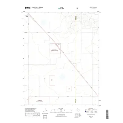
2019 Map of Kerrick
USGS Topo · Published 2019About this map
The high plains of the Texas Panhandle meet the Dallam Co and Sherman Co line in this 2019 survey, dominated by the conservation tracts of the Rita Blanca National Grassland. The small settlement of Kerrick sits at the northwestern edge, positioned where the historic Santa Fe Trl and Ranch Rd 807 converge. The landscape is defined by a grid of named rural roads, including Whittenburg Ln and Minnie Mack Ln, which overlay a terrain that transitions from flat agricultural fields to the incised drainage of the Beaver River in the northeast corner. This map provides a detailed view of the modern boundaries for the Rb Ng parcels, showing how federal land management and private holdings are interspersed across the arid landscape of the northernmost tip of Texas.
Find a feature on this map
19 named features on this map. Tap any name to fly to it.
Don’t see what you’re looking for? This feature index may not catch every label — zoom into the map to look around manually.
Map Details
Editions of this 2019 Kerrick Map
This is the sole edition of this map. No revisions or reprints were ever made.
Other maps of this area

1954 · Dalhart
USGS Topo · 1:250,000

1958 · Dalhart
USGS Topo · 1:250,000

1962 · Dalhart
USGS Topo · 1:250,000

1964 · Brickel
USGS Topo · 1:24,000

1964 · Kerrick
USGS Topo · 1:24,000

1964 · Stratford 2 SE
USGS Topo · 1:24,000

1964 · Stratford 2 NE
USGS Topo · 1:24,000

1964 · Stratford
USGS Topo · 1:24,000

1964 · Stratford NE
USGS Topo · 1:24,000

1971 · Griggs SW
USGS Topo · 1:24,000