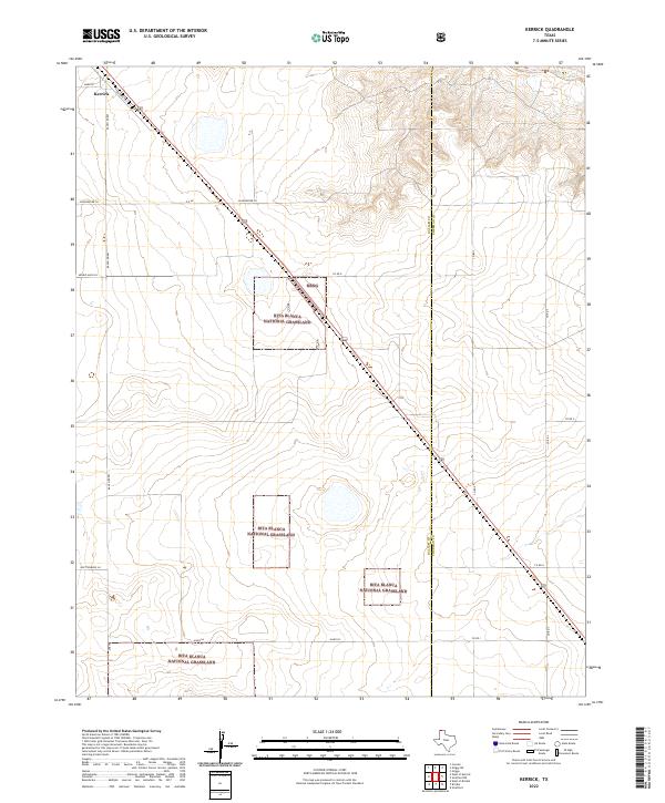
2022 Map of Kerrick
USGS Topo · Published 2022About this map
Kerrick serves as the primary hub for this portion of the Texas Panhandle, situated right along the historic Santa Fe Trl near the Oklahoma border. The landscape is dominated by the managed open spaces of the Rita Blanca National Grassland, which is distributed in several distinct blocks across the High Plains. This arrangement reflects the region's recovery and land-use adaptation following the Dust Bowl era, with modern ranching and conservation efforts side-by-side. The topography is defined by the drainage of the Beaver River in the northeastern corner, cutting through the otherwise flat terrain. The boundary between Dallam Co and Sherman Co runs vertically through the center, while a network of named local roads such as Whittenburg Ln and Schoonover Ln provide access to the surrounding ranchland.
Find a feature on this map
20 named features on this map. Tap any name to fly to it.
Don’t see what you’re looking for? This feature index may not catch every label — zoom into the map to look around manually.
Map Details
Editions of this 2022 Kerrick Map
This is the sole edition of this map. No revisions or reprints were ever made.
Other maps of this area

1954 · Dalhart
USGS Topo · 1:250,000

1958 · Dalhart
USGS Topo · 1:250,000

1962 · Dalhart
USGS Topo · 1:250,000

1964 · Brickel
USGS Topo · 1:24,000

1964 · Kerrick
USGS Topo · 1:24,000

1964 · Stratford 2 SE
USGS Topo · 1:24,000

1964 · Stratford 2 NE
USGS Topo · 1:24,000

1964 · Stratford
USGS Topo · 1:24,000

1964 · Stratford NE
USGS Topo · 1:24,000

1971 · Griggs SW
USGS Topo · 1:24,000