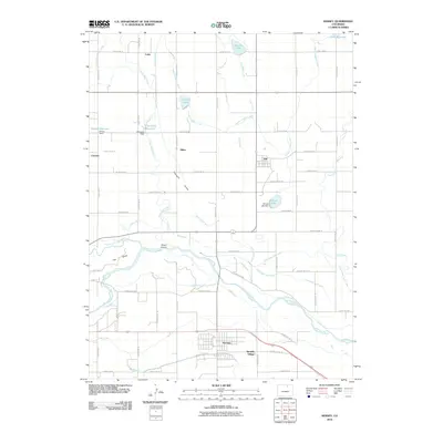
2010 Map of Kersey
USGS Topo · Published 2010About this map
The confluence of the Cache la Poudre River and the South Platte River anchors this 2010 study of the agricultural landscape east of Greeley. An intricate network of irrigation infrastructure, including the Greeley Number 2 Canal, Eaton Ditch, and Latham Ditch, demonstrates the engineered nature of the Pleasant Valley water system. This grid of canals and ditches supports a series of small rural settlements such as Kersey, Gill, and Spanish Village. Local landmarks like Darling Ranch and water features such as Briscoe Lake and Howards Lake reveal the parceling of the high plains for ranching and farming. The presence of Scout Island and The Delta at the river junction highlights the shifting hydrology of the valley floor, while the numerous county roads delineate the expansive ranch properties of Weld County.
Find a feature on this map
63 named features on this map. Tap any name to fly to it.
Don’t see what you’re looking for? This feature index may not catch every label — zoom into the map to look around manually.
Map Details
Editions of this 2010 Kersey Map
This is the sole edition of this map. No revisions or reprints were ever made.
Other maps of this area

1902 · Greeley
USGS Topo · 1:125,000

1908 · Eaton
USGS Topo · 1:125,000

1910 · Eaton
USGS Topo · 1:125,000

1950 · Greeley
USGS Topo · 1:24,000

1950 · Kersey
USGS Topo · 1:24,000

1950 · Barnesville
USGS Topo · 1:24,000

1950 · Valley View School
USGS Topo · 1:24,000

1950 · Hardin
USGS Topo · 1:24,000

1950 · La Salle
USGS Topo · 1:24,000

1951 · Hardin
USGS Topo · 1:24,000