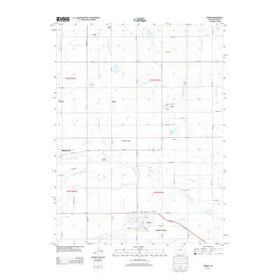
2013 Map of Kersey
USGS Topo · Published 2013About this map
The confluence of the S Platte River and the Cache la Poudre River defines this Weld County landscape, where the town of Kersey serves as a southern hub along Us-34 E. This 2013 survey illustrates a high concentration of dairy operations, including Galeton Dairy, Kerbs Dairy, Stout Dairy, and Cockroft Dairy Farms, reflecting the region's agricultural specialty. Water management is central to the area's development, evidenced by an intricate network of irrigation features such as the Greeley Number 2 Canal, Ogilvy Ditch, and Latham Ditch. These waterways support smaller communities and rural junctions like Gill, Alden, and Cloverly. In the western portion of the map, the eastern edge of Greeley meets The Delta, where Lone Tree Creek and Willow Creek feed into the river system near Scout Island. The map also captures several reservoirs and lakes, including Howards Lake and J B Cooke Reservoir, which provide critical storage in this arid environment.
Find a feature on this map
74 named features on this map. Tap any name to fly to it.
Don’t see what you’re looking for? This feature index may not catch every label — zoom into the map to look around manually.
Map Details
Editions of this 2013 Kersey Map
This is the sole edition of this map. No revisions or reprints were ever made.
Other maps of this area

1902 · Greeley
USGS Topo · 1:125,000

1908 · Eaton
USGS Topo · 1:125,000

1910 · Eaton
USGS Topo · 1:125,000

1950 · Greeley
USGS Topo · 1:24,000

1950 · Kersey
USGS Topo · 1:24,000

1950 · Barnesville
USGS Topo · 1:24,000

1950 · Valley View School
USGS Topo · 1:24,000

1950 · Hardin
USGS Topo · 1:24,000

1950 · La Salle
USGS Topo · 1:24,000

1951 · Hardin
USGS Topo · 1:24,000