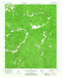
1953 Map of Ketchen
USGS Topo · Published 1967About this map
Cumberland National Forest defines the borderlands of Tennessee and Kentucky on this mid-century survey, where the deep drainage basins of Jellico Creek and Capuchin Creek meet. The map reveals a remote landscape of high ridges and narrow hollows, centered around the small settlements of Ketchen, Creekmore, and Cordell. Life here in the early 1950s was anchored by family-named landmarks and rural institutions, including the Gum Fork Ch, Upper Rock Creek Sch, and several isolated burial grounds such as the Blankenship Cem and Adkins Cem.
Find a feature on this map
72 named features on this map. Tap any name to fly to it.
Don’t see what you’re looking for? This feature index may not catch every label — zoom into the map to look around manually.
Map Details
Editions of this 1953 Ketchen Map
2 editions found
Other maps of this area

1890 · Williamsburg
USGS Topo · 1:125,000

1893 · Briceville
USGS Topo · 1:125,000

1894 · Williamsburg
USGS Topo · 1:125,000

1895 · Briceville
USGS Topo · 1:125,000

1896 · Briceville
USGS Topo · 1:125,000

1936 · Ivydell
USGS Topo · 1:24,000

1936 · Pioneer
USGS Topo · 1:24,000

1936 · La Follette
USGS Topo · 1:48,000
1946 · Ivydell
USGS Topo · 1:24,000
1946 · Pioneer
USGS Topo · 1:24,000