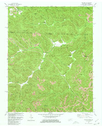
1980 Map of Ketchen
USGS Topo · Published 1980About this map
The Daniel Boone National Forest dominates the northern landscape of this border region, where the Kentucky and Tennessee state lines meet. This 1980 revision documents an area defined by heavy resource extraction, evidenced by numerous Strip Mine operations carved into the ridges of Chitwood Mountain and Anderson Mountain. The settlement of Stephens and various family-named burial sites, including Hayes Cr Cem and Adkins Cem, are concentrated along the complex drainages of Jellico Creek and Gum Fork. The terrain is marked by steep transitions between high points like Corner Tree Knob and deep hollows, reflecting a late 20th-century landscape where traditional rural life and industrial mining coexisted in the Cumberland Plateau.
Find a feature on this map
80 named features on this map. Tap any name to fly to it.
Don’t see what you’re looking for? This feature index may not catch every label — zoom into the map to look around manually.
Map Details
Editions of this 1980 Ketchen Map
2 editions found
Other maps of this area

1890 · Williamsburg
USGS Topo · 1:125,000

1893 · Briceville
USGS Topo · 1:125,000

1894 · Williamsburg
USGS Topo · 1:125,000

1895 · Briceville
USGS Topo · 1:125,000

1896 · Briceville
USGS Topo · 1:125,000

1936 · Ivydell
USGS Topo · 1:24,000

1936 · Pioneer
USGS Topo · 1:24,000

1936 · La Follette
USGS Topo · 1:48,000
1946 · Ivydell
USGS Topo · 1:24,000
1946 · Pioneer
USGS Topo · 1:24,000