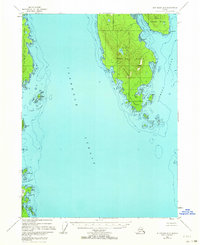
1948 Map of Ketchikan A-6
USGS Topo · Published 1964About this map
Gravina Island and the eastern edge of Prince of Wales Island dominate this coastal survey, separated by the wide expanse of the Clarence Strait. Based on 1948 aerial photography with minor revisions through 1963, the map documents a wilderness landscape defined by maritime navigation and resource extraction within the Tongass National Forest. Evidence of past industry is found at the Sawmill (Aband) located near Dall Head, indicating the area's history with the regional timber trade.
Find a feature on this map
33 named features on this map. Tap any name to fly to it.
Don’t see what you’re looking for? This feature index may not catch every label — zoom into the map to look around manually.
Map Details
Editions of this 1948 Ketchikan A-6 Map
2 editions found
Other maps of this area

1948 · Prince Rupert D-6
USGS Topo · 1:63,360

1948 · Ketchikan A-6
USGS Topo · 1:63,360

1948 · Craig A-1
USGS Topo · 1:63,360

1948 · Dixon Entrance D-1
USGS Topo · 1:63,360

1949 · Craig B-1
USGS Topo · 1:63,360

1950 · Craig B-1
USGS Topo · 1:63,360

1951 · Prince Rupert
USGS Topo · 1:250,000

1951 · Dixon Entrance
USGS Topo · 1:250,000

1951 · Prince Rupert D-6
USGS Topo · 1:63,360

1952 · Ketchikan
USGS Topo · 1:250,000