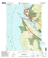
1994 Map of Ketchikan B-6
USGS Topo · Published 1998About this map
The industrial and maritime activity of the Inside Passage is centered around Ketchikan, appearing here as it developed in the late 20th century. Maritime infrastructure is prominent, including the US Coast Guard Station near Pt Higgins and the Ketchikan International Airport situated across the water on Gravina Island. Along the shoreline of Revillagigedo Island, the North Tongass Hwy connects several community hubs and industrial sites like the Pulp Mill and Cannery at Ward Cove. Recreational and cultural preservation is evident at Totem Bight State Hist Park and Refuge Cove State Rec Site, while much of the inland territory remains within the Tongass National Forest. Topography ranges from the maritime hazards of Rosa Reef and Vallenar Rock to the prominent heights of Sullivan Mtn and Bostwick Ridge.
Find a feature on this map
92 named features on this map. Tap any name to fly to it.
Don’t see what you’re looking for? This feature index may not catch every label — zoom into the map to look around manually.
Map Details
Editions of this 1994 Ketchikan B-6 Map
This is the sole edition of this map. No revisions or reprints were ever made.
Other maps of this area

1948 · Ketchikan A-6
USGS Topo · 1:63,360

1948 · Craig A-1
USGS Topo · 1:63,360

1948 · Ketchikan C-5
USGS Topo · 1:63,360

1949 · Ketchikan C-6
USGS Topo · 1:63,360

1949 · Craig B-1
USGS Topo · 1:63,360

1950 · Craig B-1
USGS Topo · 1:63,360

1950 · Craig C-1
USGS Topo · 1:63,360

1951 · Craig C-1
USGS Topo · 1:63,360

1952 · Ketchikan
USGS Topo · 1:250,000

1952 · Ketchikan C-6
USGS Topo · 1:63,360