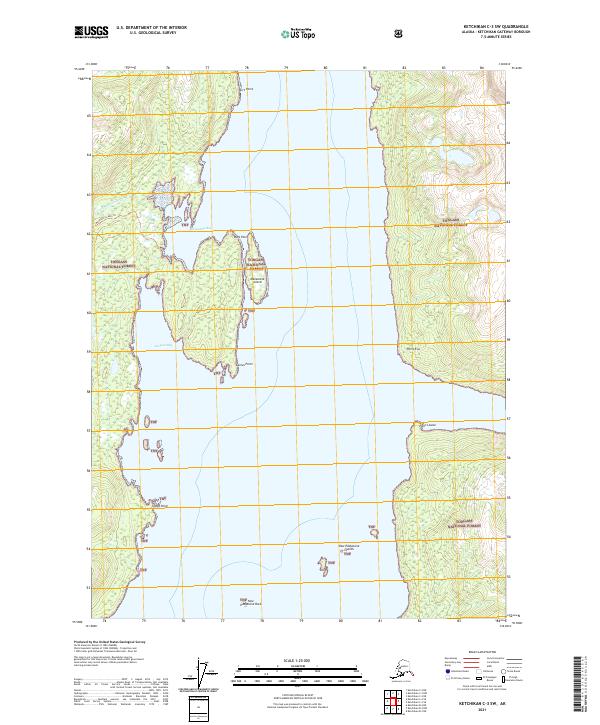
2021 Map of Ketchikan C-3 SW
USGS Topo · Published 2021About this map
Manzanita Bay and Sargent Bay dominate this coastal section of the Tongass National Forest, where the complex shoreline of southeast Alaska is charted in detail. The landscape is defined by its maritime access points, including Skirt Point to the north and Tramp Point to the south. Notable geological features rise from the water, such as the distinctive New Eddystone Rock and the New Eddystone Islands, which serve as significant navigational landmarks within the Behm Canal region. On land, the Manzanita Lake Trl provides a mapped route through the timbered interior, connecting the coast toward the drainage of N Fork Manzanita Cr. This survey illustrates the relationship between the protected waters and the dense forest, capturing specific points of interest like Point Eva and Point Louise that delineate the intricate coast.
Find a feature on this map
19 named features on this map. Tap any name to fly to it.
Don’t see what you’re looking for? This feature index may not catch every label — zoom into the map to look around manually.
Map Details
Editions of this 2021 Ketchikan C-3 SW Map
This is the sole edition of this map. No revisions or reprints were ever made.
Other maps of this area

1949 · Ketchikan B-4
USGS Topo · 1:63,360

1952 · Ketchikan
USGS Topo · 1:250,000

1952 · Ketchikan B-4
USGS Topo · 1:63,360

1952 · Ketchikan C-4
USGS Topo · 1:63,360

1955 · Ketchikan C-3
USGS Topo · 1:63,360

1955 · Ketchikan B-3
USGS Topo · 1:63,360

1955 · Ketchikan C-4
USGS Topo · 1:63,360

1955 · Ketchikan
USGS Topo · 1:250,000
1995 · Ketchikan C-4
USGS Topo · 1:63,360
1995 · Ketchikan B-4
USGS Topo · 1:63,360