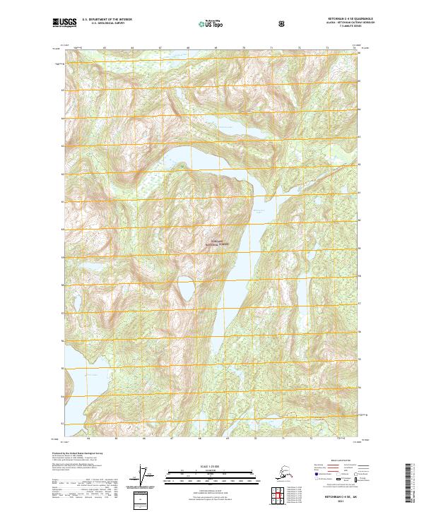
2021 Map of Ketchikan C-4 SE
USGS Topo · Published 2021About this map
Tongass National Forest encompasses the entirety of this coastal Alaskan landscape, where a series of inland lakes and glacial drainages define the interior of Revillagigedo Island. Large bodies of water like Manzanita Lake and Lake Grace are primary landmarks, connected by a network of steep-sided valleys and tributaries such as Grace Cr and Manzanita Cr. This modern survey illustrates the limited human footprint in the region, primarily represented by wilderness access routes like the Manzanita Lake Trl and Ella Lake Trl. Other significant water bodies including January Lake, Mirror Lake, and Lower Ella Lake dot the terrain, while Fromholz Cr drains the northeastern portion of the quadrangle. The lack of settlements or roads underscores the preservation of this region as part of the national forest system, where the environment remains shaped by natural hydrology.
Find a feature on this map
17 named features on this map. Tap any name to fly to it.
Don’t see what you’re looking for? This feature index may not catch every label — zoom into the map to look around manually.
Map Details
Editions of this 2021 Ketchikan C-4 SE Map
This is the sole edition of this map. No revisions or reprints were ever made.
Other maps of this area

1949 · Ketchikan B-4
USGS Topo · 1:63,360

1952 · Ketchikan
USGS Topo · 1:250,000

1952 · Ketchikan B-4
USGS Topo · 1:63,360

1952 · Ketchikan C-4
USGS Topo · 1:63,360

1955 · Ketchikan C-3
USGS Topo · 1:63,360

1955 · Ketchikan B-3
USGS Topo · 1:63,360

1955 · Ketchikan C-4
USGS Topo · 1:63,360

1955 · Ketchikan
USGS Topo · 1:250,000
1995 · Ketchikan C-4
USGS Topo · 1:63,360
1995 · Ketchikan B-4
USGS Topo · 1:63,360