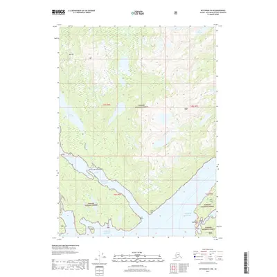
2017 Map of Ketchikan D-6 NE
USGS Topo · Published 2017About this map
Yes Bay Lodge Seaplane Base sits on the northern edge of Yes Bay, providing a vital maritime link in this southeastern Alaskan wilderness. The landscape is defined by its dramatic relief and freshwater resources, including the significant reach of Lake McDonald and smaller upland bodies like Lake Rowena and Lake Maude. This section of the Tongass National Forest showcases the complex interplay of high-altitude features like Bald Mtn and Twin Rift against the deep saltwater inlets of the Gulf of Alaska. Navigational markers along the coast, such as Syble Point and Bluff Point, anchor the shoreline where Wolverine Cr meets the sea. The map reveals a region where transportation is dictated by the water, centering on the remote seaplane facility and the islands of Black Island and Hassler Island.
Find a feature on this map
21 named features on this map. Tap any name to fly to it.
Don’t see what you’re looking for? This feature index may not catch every label — zoom into the map to look around manually.
Map Details
Editions of this 2017 Ketchikan D-6 NE Map
This is the sole edition of this map. No revisions or reprints were ever made.
Other maps of this area

1951 · Bradfield Canal
USGS Topo · 1:250,000

1952 · Ketchikan
USGS Topo · 1:250,000

1952 · Ketchikan D-5
USGS Topo · 1:63,360

1952 · Ketchikan D-6
USGS Topo · 1:63,360

1953 · Ketchikan D-5
USGS Topo · 1:63,360

1953 · Ketchikan D-6
USGS Topo · 1:63,360

1954 · Bradfield Canal
USGS Topo · 1:250,000

1955 · Bradfield canal A-6
USGS Topo · 1:63,360

1955 · Bradfield Canal A-5
USGS Topo · 1:63,360

1955 · Ketchikan
USGS Topo · 1:250,000