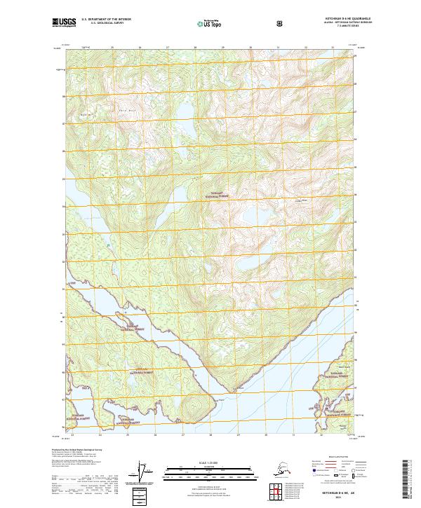
2021 Map of Ketchikan D-6 NE
USGS Topo · Published 2021About this map
Lake McDonald and the winding waters of Yes Bay define this coastal reach of the Tongass National Forest in Southeast Alaska. The landscape is characterized by steep topographic shifts, rising from the marine environment of Blind Passage to high points like Bald Mtn and the distinct geological formation of Twin Rift. Waterways such as Wolverine Cr and Spring Cr drain the uplands, cutting through the dense forest towards the irregular shoreline. This 2021 survey details the complex coastal geography, identifying several island landmasses including Black Island and a portion of Hassler Island. Notable maritime landmarks like Indian Point, Bluff Point, and Syble Point provide essential orientation along the bay, reflecting the area's ongoing importance for navigation and forest management within the Alaska Panhandle.
Find a feature on this map
18 named features on this map. Tap any name to fly to it.
Don’t see what you’re looking for? This feature index may not catch every label — zoom into the map to look around manually.
Map Details
Editions of this 2021 Ketchikan D-6 NE Map
This is the sole edition of this map. No revisions or reprints were ever made.
Other maps of this area

1951 · Bradfield Canal
USGS Topo · 1:250,000

1952 · Ketchikan
USGS Topo · 1:250,000

1952 · Ketchikan D-5
USGS Topo · 1:63,360

1952 · Ketchikan D-6
USGS Topo · 1:63,360

1953 · Ketchikan D-5
USGS Topo · 1:63,360

1953 · Ketchikan D-6
USGS Topo · 1:63,360

1954 · Bradfield Canal
USGS Topo · 1:250,000

1955 · Bradfield canal A-6
USGS Topo · 1:63,360

1955 · Bradfield Canal A-5
USGS Topo · 1:63,360

1955 · Ketchikan
USGS Topo · 1:250,000