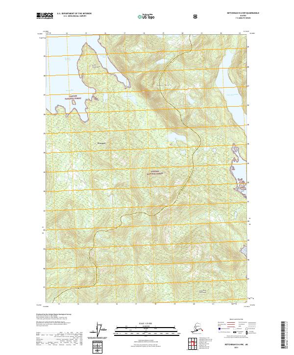
2021 Map of Ketchikan D-6 NW
USGS Topo · Published 2021About this map
Tongass National Forest dominates this coastal landscape, which depicts the administrative boundary between Wrangell City and Borough and the Ketchikan Gateway Borough. The terrain is defined by the steep rises of the Cleveland Peninsula and the prominent summit of Table Mtn, illustrating the complex maritime geography of Southeast Alaska. Water features are central to the region's character, with Seward Passage and Santa Anna Inlet cutting into the coastline near Point Santa Anna. Further inland, isolated freshwater bodies like Lake McDonald and Lake Helen are tucked into the high elevations. The placement of the Wrangell label over the forested hillsides indicates the broad reach of the borough's jurisdiction across these remote lands and waterways like Sunny Bay.
Find a feature on this map
17 named features on this map. Tap any name to fly to it.
Don’t see what you’re looking for? This feature index may not catch every label — zoom into the map to look around manually.
Map Details
Editions of this 2021 Ketchikan D-6 NW Map
This is the sole edition of this map. No revisions or reprints were ever made.
Other maps of this area

1948 · Petersburg A-1
USGS Topo · 1:63,360

1949 · Craig D-1
USGS Topo · 1:63,360

1951 · Bradfield Canal
USGS Topo · 1:250,000

1951 · Craig D-1
USGS Topo · 1:63,360

1951 · Petersburg A-1
USGS Topo · 1:63,360

1952 · Petersburg
USGS Topo · 1:250,000

1952 · Ketchikan
USGS Topo · 1:250,000

1952 · Ketchikan D-6
USGS Topo · 1:63,360

1953 · Ketchikan D-6
USGS Topo · 1:63,360

1954 · Bradfield Canal
USGS Topo · 1:250,000