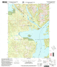
2000 Map of Ketchikan D-6
USGS Topo · Published 2003About this map
The Cleveland Peninsula and Revillagigedo Island define this coastal landscape, where the waters of Behm Canal and Gedney Pass separate major landmasses within the Tongass National Forest. The map documents a maritime environment punctuated by essential wilderness infrastructure, including the McDonald Lake Cabin (FS) and McDonald Lake Shelter (FS) near the expansive Lake Mc Donald.
Find a feature on this map
39 named features on this map. Tap any name to fly to it.
Don’t see what you’re looking for? This feature index may not catch every label — zoom into the map to look around manually.
Map Details
Editions of this 2000 Ketchikan D-6 Map
This is the sole edition of this map. No revisions or reprints were ever made.
Other maps of this area

1948 · Petersburg A-1
USGS Topo · 1:63,360

1948 · Ketchikan C-5
USGS Topo · 1:63,360

1949 · Ketchikan C-6
USGS Topo · 1:63,360

1949 · Craig D-1
USGS Topo · 1:63,360

1950 · Craig C-1
USGS Topo · 1:63,360

1951 · Bradfield Canal
USGS Topo · 1:250,000

1951 · Craig C-1
USGS Topo · 1:63,360

1951 · Craig D-1
USGS Topo · 1:63,360

1951 · Petersburg A-1
USGS Topo · 1:63,360

1952 · Petersburg
USGS Topo · 1:250,000