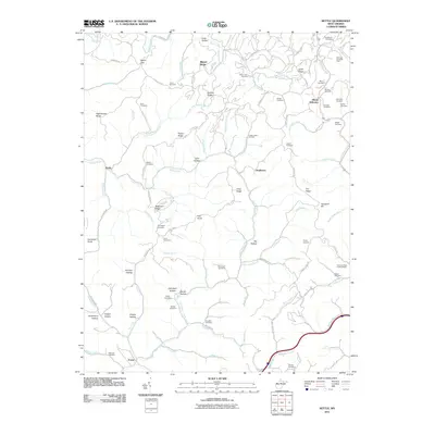
2011 Map of Kettle
USGS Topo · Published 2011About this map
McKown Creek Oil Field and the Rock Creek Oil Field define the industrial footprint of this Roane County landscape, where the extraction of natural resources shapes the terrain. The region is marked by a high density of family and community burial grounds, such as Canterbury Cemetery, Ritchea Cemetery, and Hively Cemetery, providing a significant record for genealogical research. Settlements like Doddtown, Kettle, and Mount Welcome are linked by a network of ridges and hollows, including Lynch Ridge and Big Hollow. The Foreman Knob Lookout Tower stands as a prominent landmark overlooking the many branches of the Pocatalico River and Poca Fork. This survey documents a rural Appalachian community where topographic features like Gunstock Knob and Frail Knob dictate the path of local roads and the distribution of small valley hamlets.
Find a feature on this map
106 named features on this map. Tap any name to fly to it.
Don’t see what you’re looking for? This feature index may not catch every label — zoom into the map to look around manually.
Map Details
Editions of this 2011 Kettle Map
This is the sole edition of this map. No revisions or reprints were ever made.
Other maps of this area

1897 · Kanawha Falls
USGS Topo · 1:125,000

1899 · Charleston
USGS Topo · 1:125,000

1900 · Kanawha Falls
USGS Topo · 1:125,000

1901 · Kanawha Falls
USGS Topo · 1:125,000

1906 · Kenna
USGS Topo · 1:62,500

1906 · Walton
USGS Topo · 1:62,500

1907 · Kenna
USGS Topo · 1:62,500

1907 · Walton
USGS Topo · 1:62,500

1907 · Clendenin
USGS Topo · 1:62,500

1909 · Charleston
USGS Topo · 1:62,500