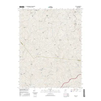
2016 Map of Kettle
USGS Topo · Published 2016About this map
The Pocatalico River flows across the northern edge of this landscape, a region defined by narrow ridges and winding hollows along the Roane and Kanawha county line. Small settlements like Mount Hope, Ambler Ridge, and Doddtown are connected by a network of county roads that follow the complex terrain of Pigeonroost Ridge and Lynch Ridge. For those researching local history, the map provides a look at the rural character of the area in the early 21st century, documented by the placement of family-named cemeteries and landmarks like the Pocatalico River Road Truss Bridge. Numerous family burial grounds, including the Ritchea Cem, Paxton Cem, and Pauley Cem, are scattered throughout the hills, often situated near high points like Gunstock Knob or along the drainage of Little Sandy Creek. The crossing of Interstate 79 at the I-79 Willis Creek Overpass serves as a modern contrast to the older infrastructure of the McKown Creek Slab Bridge.
Find a feature on this map
124 named features on this map. Tap any name to fly to it.
Don’t see what you’re looking for? This feature index may not catch every label — zoom into the map to look around manually.
Map Details
Editions of this 2016 Kettle Map
This is the sole edition of this map. No revisions or reprints were ever made.
Other maps of this area

1897 · Kanawha Falls
USGS Topo · 1:125,000

1899 · Charleston
USGS Topo · 1:125,000

1900 · Kanawha Falls
USGS Topo · 1:125,000

1901 · Kanawha Falls
USGS Topo · 1:125,000

1906 · Kenna
USGS Topo · 1:62,500

1906 · Walton
USGS Topo · 1:62,500

1907 · Kenna
USGS Topo · 1:62,500

1907 · Walton
USGS Topo · 1:62,500

1907 · Clendenin
USGS Topo · 1:62,500

1909 · Charleston
USGS Topo · 1:62,500