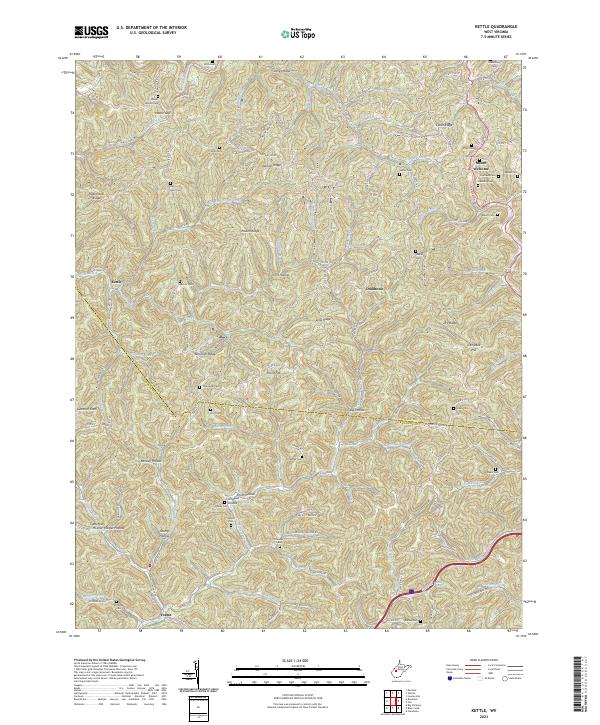
2023 Map of Kettle
USGS Topo · Published 2023About this map
The Pocatalico River and its myriad tributaries carve through the borderlands of Roane and Kanawha counties, defining a landscape of narrow hollows and high ridges. The settlement of Kettle sits tucked along the river, while Doddtown and Mount Welcome occupy the higher ground to the east. This area is characterized by a high density of family and community burial grounds, including Mount Moriah Cem, Jarvis Cem, and Hively Cem, which speak to generations of rural residency along the winding Kettle Rd and Charleston Rd. Significant ridges like Ambler Ridge and Pigeonroost Ridge separate the various drainages, such as Left Hand Creek and Hurricane Branch, illustrating the historical reliance on local ridge-top and creek-bottom paths for travel through the Appalachian foothills.
Find a feature on this map
129 named features on this map. Tap any name to fly to it.
Don’t see what you’re looking for? This feature index may not catch every label — zoom into the map to look around manually.
Map Details
Editions of this 2023 Kettle Map
This is the sole edition of this map. No revisions or reprints were ever made.
Other maps of this area

1897 · Kanawha Falls
USGS Topo · 1:125,000

1899 · Charleston
USGS Topo · 1:125,000

1900 · Kanawha Falls
USGS Topo · 1:125,000

1901 · Kanawha Falls
USGS Topo · 1:125,000

1906 · Kenna
USGS Topo · 1:62,500

1906 · Walton
USGS Topo · 1:62,500

1907 · Kenna
USGS Topo · 1:62,500

1907 · Walton
USGS Topo · 1:62,500

1907 · Clendenin
USGS Topo · 1:62,500

1909 · Charleston
USGS Topo · 1:62,500