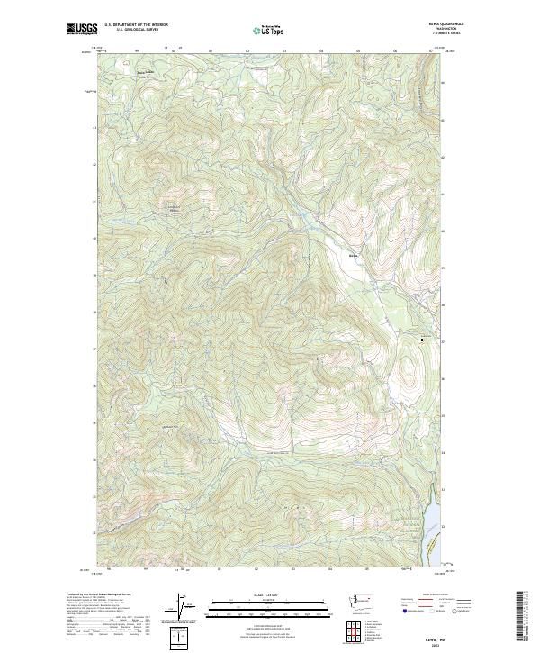
2023 Map of Kewa
USGS Topo · Published 2023About this map
Kewa and Twin Lakes anchor this part of Ferry County, where the landscape transitions into the high elevations of the Colville Indian Reservation. The drainage systems of Stranger Creek and Nez Perce Creek define the local topography, carving through deep features like Stray Dog Canyon. Towards the southeast, the terrain descends toward the Columbia River and the expansive Lake Roosevelt National Recreation Area, marking the boundary with Stevens County.
Find a feature on this map
32 named features on this map. Tap any name to fly to it.
Don’t see what you’re looking for? This feature index may not catch every label — zoom into the map to look around manually.
Map Details
Editions of this 2023 Kewa Map
This is the sole edition of this map. No revisions or reprints were ever made.
Other maps of this area

1948 · Hunters
USGS Topo · 1:62,500

1948 · Wilmont Creek
USGS Topo · 1:62,500

1950 · Wilmont Creek
USGS Topo · 1:62,500

1950 · Hunters
USGS Topo · 1:62,500

1950 · Inchelium
USGS Topo · 1:62,500

1952 · Twin Lakes
USGS Topo · 1:62,500

1954 · Okanogan
USGS Topo · 1:250,000

1956 · Wilmont Creek
USGS Topo · 1:62,500

1958 · Okanogan
USGS Topo · 1:250,000

1984 · Nespelem
USGS Topo · 1:100,000