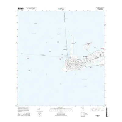
2015 Map of Key West
USGS Topo · Published 2015About this map
The dense grid of Key West occupies the eastern portion of this coastal survey, where maritime corridors and developed keys define the island's character. Significant maritime infrastructure is prominent, including the Key West International Airport and the complex of channels such as the Main Ship Channel and Garrison Bight Channel that facilitate movement between the Atlantic Ocean and the Intracoastal Waterway. The map details the transition from urban centers like the Southern Keys to specialized landmasses like Trumbo Point and Fleming Key.
Find a feature on this map
87 named features on this map. Tap any name to fly to it.
Don’t see what you’re looking for? This feature index may not catch every label — zoom into the map to look around manually.
Map Details
Editions of this 2015 Key West Map
This is the sole edition of this map. No revisions or reprints were ever made.
Other maps of this area

1921 · Sugar Loaf Key
USGS Topo · 1:62,500

1921 · Key West
USGS Topo · 1:62,500

1943 · Bay Keys
USGS Topo · 1:24,000

1943 · Boca Chica
USGS Topo · 1:24,000

1943 · Key West
USGS Topo · 1:24,000

1943 · Snipe Keys
USGS Topo · 1:24,000

1943 · Cottrell Key
USGS Topo · 1:24,000

1962 · Key West
USGS Topo · 1:24,000

1963 · Cottrell Key
USGS Topo · 1:24,000

1971 · Key West
USGS Topo · 1:24,000