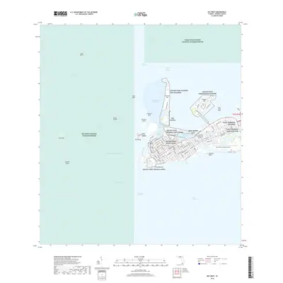
2018 Map of Key West
USGS Topo · Published 2018About this map
Key West serves as the focal point of this island survey, revealing a landscape defined by its strategic naval presence and complex coastal geography. The southern tip of the island is dominated by military installations including the NAS Key West Truman Annex and NAS Key West Peary Court, while the historic street grid extends from Duval St through the central district toward the Key West Cem. These urban areas give way to significant maritime infrastructure, from the Key West Bight to the expansive Key West International Airport on the eastern edge.
Find a feature on this map
99 named features on this map. Tap any name to fly to it.
Don’t see what you’re looking for? This feature index may not catch every label — zoom into the map to look around manually.
Map Details
Editions of this 2018 Key West Map
This is the sole edition of this map. No revisions or reprints were ever made.
Other maps of this area

1921 · Sugar Loaf Key
USGS Topo · 1:62,500

1921 · Key West
USGS Topo · 1:62,500

1943 · Bay Keys
USGS Topo · 1:24,000

1943 · Boca Chica
USGS Topo · 1:24,000

1943 · Key West
USGS Topo · 1:24,000

1943 · Snipe Keys
USGS Topo · 1:24,000

1943 · Cottrell Key
USGS Topo · 1:24,000

1962 · Key West
USGS Topo · 1:24,000

1963 · Cottrell Key
USGS Topo · 1:24,000

1971 · Key West
USGS Topo · 1:24,000